Current Solutions: Steps Taken to Overcome the Loss of America's WETLAND
VIII. ACTION STEPS. The following is a discussion of the many activities that are expected to have a positive impact on coastal marsh restoration.
1. Freshwater diversion. By definition, freshwater diversion is simply diverting the flow of freshwater into a desired area. The purpose may be simply to place more water in the chosen site or, most commonly in southern Louisiana, to use freshwater to push salt water back, thus diversifying existing wetlands. There are three types of diversion projects: controlled diversions, siphons, and small-scale diversions.
- Controlled Diversions. First suggested in 1973, controlled freshwater diversions would allow Mississippi River water (and some sediments and nutrients) to flow into the marsh through concrete structures built in the levee.

The advantage provided is that the freshwater pushes back intruded saltwater and introduces some sediment and many nutrients. These are controlled by the construction of large, concrete structures that allow the flow of river water to be regulated.
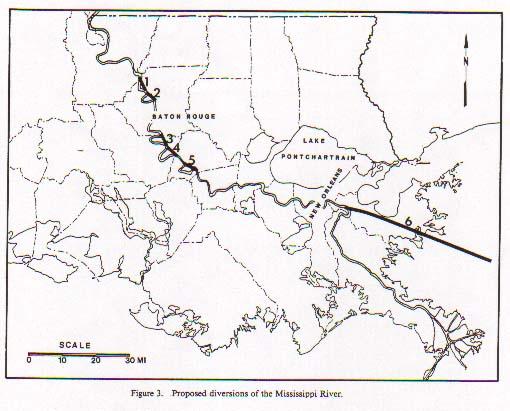
The U.S. Army Corps of Engineers has identified, and Congress has authorized, three places for diversions:
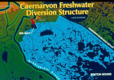
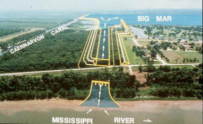
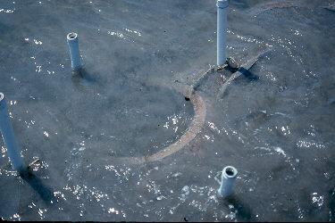
i. Caernarvon Freshwater Diversion - Located on the east bank of the Mississippi River south of New Orleans, this is the site of the first constructed diversion structure that was completed in 1991. It transports river water into Big Mar. This structure is designed to have a maximum flow rate of 8,000 cfs and to produce 16,000 ac (25 sq mi) of renewed marsh.
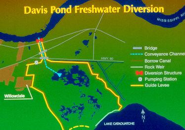
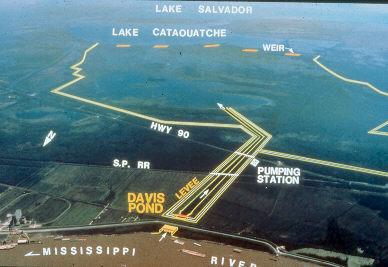
ii. Davis Pond Freshwater Diversion - This structure, opened in 2002, is located on the west bank of the river above New Orleans near Edgard. It will provide freshwater into the Barataria Basin via Lakes Cataouatche and Salvador. This structure is projected to have a maximum flow rate of 10,650 cfs and to produce 83,000 ac (130 sq mi) of renewed marsh.
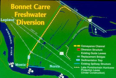
iii. Bonnet Carré Freshwater Diversion - This is the most controversial structure that has been discussed. It is still authorized, but not likely to be built in the form shown in the figure here. Most of the controversy has centered on whether we want to risk potential contamination of the resources of Lake Pontchartrain, into which it will introduce river water. The location originally planned for use is the north side of the spillway inside the existing guide levee. This structure was projected to have a maximum flow rate of 30,000 cfs and to produce some 10,500 ac (16.4 sq mi) of renewed marsh.
The present driving force behind this diversion is the State of Mississippi. They believe the diversion will have a positive economic impact on their fisheries programs.
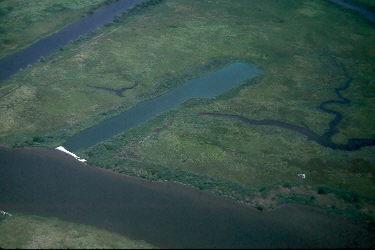
A number of ecologists and environmental groups have suggested that a system be designed that allows high water flow from the river to pass through the LaBranche Wetlands, mimicking the natural ecosystem that preexisted levees. The positive impacts will include 1) slowing he movement of fresh water from the river into the brackish Lake Pontchartrain, 2) freshening the LaBranche Wetlands that have become too salty, and 3) allowing standing wetland vegetation to remove nutrients and other chemicals from the water before it enters Lake Pontchartrain.
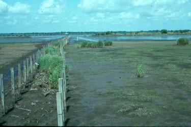
LaBranche Wetlands, looking toward Lake Pontchartrain, September 2003
Purpose of the diversion plans: To move freshwater into marshes that are becoming salty due to saltwater intrusion. The diverted water will convert the nearest marshes back to freshwater habitats, thus increasing diversity of the existing marsh.
Note: These diversions are designed to move water, not sediment. Over the diversions' projected 50 year life, they will create the amounts of renewed marsh that are mentioned above (a total of 109,000 ac, which is equal to 171 sq mi, or 3.42 sq mi/yr). In order to have progress, large scale diversions (10 times the size of those listed above) of both water and sediment should be constructed.
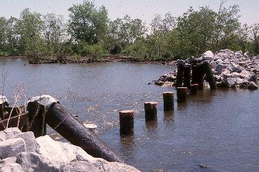
b. Siphons. These are relatively small diversions that take place by siphoning water from the river over the levee through pipes. There are many now in operation, but two of the best known are the Violet and White Ditch siphons. Each siphon consists of two large pipes that can move a maximum of 250 cfs. Their purpose is to rediversify a marsh in St. Bernard Parish (Violet) and Plaquemines (White Ditch) parishes.
The following photos are of the White-ditch Siphons on LA 39 (east side of the Mississippi River) in Plaquemines Parish:

Water is sucked up from the river.

Water is siphoned in pipes over the levee.

Water is flushed into a canal and delivered into the marsh.
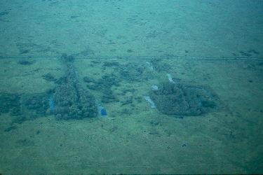
c. Small-scale diversions. In recent years, there have been many smaller projects whereby small crevasses have been constructed to allow splay development. These differ from the other two types of diversions in that they are uncontrolled (no large structure) and are usually very small. They appear to be working well.

In fact, virtually any place an opening in a levee occurs (called a crevasse), a mini-delta begins to form. This photo was taken along a canal near Venice, LA. It shows a progression of delta development at three crevasses:
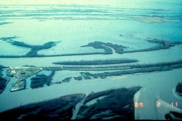
USACOE 2-11-1987
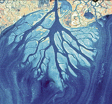
d. Larger-scale diversions. Many people believe that we should open numerous simple crevasses in the levees south of New Orleans. Though this may sound so easy that it would have little effect, it actually could help a lot. In about 1861, a family by the name of Cubitt created such an opening in the levee on the east side of the Mississippi River just above where Pilot Town is located today. This opening, now called Cubit's Gap (the second "t" was dropped), today carries about 10% of the total flow of the Mississippi River.
There are two stories detailing specifics about how this opening came to be, and both are attributed to the Dick Cubitt family. The first is that as oysterman Dick Cubitt became older, he had trouble moving his boat over the natural levee between the Mississippi River and Bay Ronde, an oyster rich body of water. One day he and/or his daughters, Martha and Anne (Harnett T. Kane, 1944, p. 138, gives sole credit to the daughters), took their shovels and made a shallow opening and, bingo, the river took over! Locals called it Oyster Canal. The other version is that Martha and Anne had to walk down the levee to get the family’s cows at the end of each day. The cows roamed farther and farther down the levee, so one day the girls took a shovel and cut a trench across the levee so the cows could go no farther. The rest is history. Regardless of which story is true, it shows how the river can take advantage of a little help and how rich the resulting wetlands can be.
Cubit’s Gap started as a trickle, but high waters in 1862 widened the crevasse to mega proportions. By 1870, it was 2,427 feet wide. By 1940, a massive vegetated wetland the size of New Orleans had formed and Bay Ronde was no more. Today this wetland is the Delta National Wildlife Refuge.

The large opening on the left side of the river is Cubit’s Gap. The three distributary split in the upper center is Head of Passes, with Southwest Pass (the one used for commercial shipping) heading to the right. Photo taken facing south, hence Cubit’s Gap is on the east side and Southwest Pass flows to the southwest.
There are many such stories in south Louisiana. Coupe a Bel was a cut made in the barrier island just east of Grand Terre by a Mr. Bel. Craque a Methune is located on the Lafourche/Jefferson boundry and was allegedly formed when a little girl dug a trench with her spoon.
In late 2003, the USACOE launched a new larger-scale diversion on the west bank of the Mississippi River south of Venice (just north of Cubit’s Gap). It is a ditch, dug at an angle to the northwest with hopes that this angle will prevent the river from totally following that pathway, thus causing problems for Southwest Pass. This project’s purpose is to ultimately build 10,000 acres of marsh in an area that has become open water. If this is successful, other such project will certainly follow.

Louisiana's wetland loss is too important to simply stop at three controlled diversions.
Potential problems: As long as large projects are considered the solution, they may take forever to complete. The following illustration shows the time span of typical Corps of Engineers projects as of the 1990s:

Human economic activities will be displaced. This will hurt in the short term, but be very beneficial in the long term. Some human population centers may be displaced or will require individual flood protection levees.
Two questions should be asked: 1) Will the diversion affect water quality? 2) Will it mimic Mother Nature?
A serious issue in the early 1990s, and occasionally recurring, is the impact of diversions on the oyster industry. The best and most productive oyster reefs develop within relatively narrow salinity ranges. They expand slowly over years under stable conditions. If one suddenly allows freshwater to flow over them, they die and the oystermen lose their livelihoods. If we are to create new diversions to offset the impacts of coastal erosion, then we should develop a plan to provide for the oystermen. Environmental solutions must always address social justice issues, otherwise much time and energy is spent arguing the impacts of the proposed solutions.
- Rerouting the mouth of the Mississippi River. A novel concept was discussed by the late Dr. Joe Martinez (1986) wherein he suggested that the Mississippi River be diverted south of New Orleans (immediately south of Chalmette) onto the continental shelf through St. Bernard Parish.
This will solve two problems:
A. It will begin to place river borne sediments on the shelf in Breton Sound and hopefully fill it in to the Chandeleur Islands. This can rebuild many, many square miles of coastal wetlands.
B. It will push the salt water back that is entering coastal marshes via the MRGO. This will affect the following:
a. Stop the negative impact of salt on the non-salt marsh.
b. Stop tidal activity from stripping the marsh of its organic detritus and soils.
c. Stop salt water from entering Lake Pontchartrain through the Seabrook area.
d. It will allow the marshes of St. Bernard Parish to rediversify since there will be gradients of salinity present.
There are many economic advantages, too. Shipping will be facilitated since the route up river would be shorter. Dredging will be less expensive because of shorter distances plus more efficient hydrolics due to river flow speeds. Expensive programs to stabilize bank erosion may become obsolete. This should help potential flooding of New Orleans because it will afford less resistance for water flowing past the city.
There has been an effort by a group of business people in the shipping industry to consider moving the port (especially for containerized shipping) nearer the present mouth of the Mississippi. Sites mentioned include Venice and Port Fourchon. The concept is that shipping companies will save money, thus making Louisiana a more economic venue than, say, Houston or Mobile. Goods would be off-loaded onto barges to move up river.
Such a decision would include the potential for a new channel for the Mississippi River.
---Potential problems: Initial financial cost would be very high. Present landowners and users will be affected. The politics of doing something of this magnitude (and sanity) would be monumental. We must pray for elected officials who possess intellectual honesty and political courage!
- Atchafalaya River system. Since the 1940s (as of 2012), more than 78 sq mi of lakes and backwaters within the Atchafalaya River Basin have naturally filled in with sediment. As of that date, these deltaic marshes are located in Main Delta at the mouth of the Atchafalaya (24000 acres) and Wax Delta at Wax Lake Outlet or Calumet Cut (16000 acres). By 2060, it is estimated that 67,000 ac (105 sq mi) of new deltaic marsh will exist at the Atchafalaya’s mouth.
This is the only area on Louisiana's coast where significant increases have occurred since the 1950s.
The U.S. Army Corps of Engineers predicts that a maximum of 200,000 ac (312 sq mi) of delta will be produced by the Atchafalaya River System.
Potential problems: Present water uses will change. This has already occurred with the filling in of Grand and Six Mile lakes.
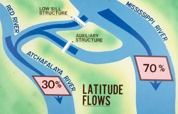
4. Increasing the flow of the Atchafalaya River. At present, of all the water flowing down the Mississippi, Red, and Ouachita rivers, 30% normally flows through the Atchafalaya River and 70% down the Mississippi River. Some propose increasing the Atchafalaya River's flow to promote delta building in Atchafalaya Bay. U.S. Army Corps of Engineers says that their models tell them that the 70%/30% split is the most efficient and should not be changed. There are two important issues at play:
1. The 70/30 split was chosen only because that is what the situation was when the decision was made to control this aspect of the river.
2. The Atchafalaya Delta is about maxed out in terms of how big it can get. More sediment may not increase the size of the delta at all.
Potential problems: A change in percentage flows will necessitate population relocation. In communities such as Morgan City, much investment in contemporary water handling systems will have to be abandoned. Folks in Butte Larose and adjacent areas will be affected.
5. Control of canals and channelization projects. First of all, it is now very difficult to acquire a permit to construct a new channel in the coastal wetlands. At one time, it was done with reckless abandon.
There is constant discussion about back-filling existing canals. Though this seems perfectly logical and common-sense indicates that it must happen, there are difficulties. Much of the soil in our coastal marshes is extremely high in peat content and, once it is removed by a dredge bucket, it pours like liquid. It does not stack nicely on the bank so that it can later be moved back into the channel. When the soil type allows backfilling, however, the process should be done and frequently is today.
When it cannot be done, even with existing canals and channels, an investigation should be done regarding the merits of plugging existing canals, thus stopping 1) further saltwater intrusion and 2) boat traffic whose wakes erode the banks. A plugged canal may eventually become shallower, or even fill in all the way, due to less water movement allowing sediments to settle out. Recent studies have shown that these two events do not always occur. Scientists are trying to find out why.
Potential problems: Very costly. Backfill materials for old canals are not readily available.
6. Dredging. In the past, sediment dredged from the river bottom was either lost (e.g., over the edge of the continental shelf) or randomly dumped by hopper dredges. The present philosophy is to place the valuable sediments where they will best restore wetlands. To do this, the dredging industry introduced suction dredges, which operate by sucking up the sediment like a vacuum cleaner and sending it through a floating pipeline until it exits in the desired location. When that place is finished, the operators simply move the end of the pipe to a new place.

A cutter-head pipeline dredge in action. Note how shallow the water is getting at the top right of the photo.

The Corps of Engineers placed a stone wall along the edge of the river, then filled in behind it with dredge materials.
Also, see the discussion of spray dredging below.
---Potential problems: This type of dredging is very costly, but it appears that the final product is worth the expense.
7. Spoil bank solutions. Again, there are today more strenuous regulations regarding producing new spoil banks. In 1988, new spoil banks amounted to only 0.5% of all preexisting spoil banks. This is a good trend.
In many areas, direct removal of spoil banks is occurring.
Making cuts in spoil banks may often help restore the region's natural hydrology.
Spray dredging should be encouraged. This technique requires a special type of dredge that removes the soil and sprays it over the adjacent marsh up to 300 ft away, eliminating the production of spoil banks by bucket dredges while at the same time adding to the soil content of the marsh.


Another solution, pioneered by the Corps of Engineers in the LaBranche Wetlands (near mile marker 214 off I-10 lake side), is to build levees (small spoil banks) that are designed to eventually collapse. In the LaBranche Wetlands, the Corps built levees and filled the newly formed "bowl" with soil pumped in from the bottom of the adjacent Lake Pontchartrain. They then planted marsh grasses. In fulfillment of the plan, after the marsh grasses became established, the levees began to collapse, thus uniting the newly formed marsh with the tidal flow of the lake. As a result, what was once an open body of water is now a higher, heavily vegetated marsh.
Potential problems: Most of this is a "new" cost that may be passed on to consumers (remember the importance of attitude adjustment). Long range impacts of spray dredging are unknown.
8. Directional drilling. Directional drilling should be done from open water so that wetlands are not directly impacted. Using this technique, fewer channels need to be dredged. This is very widely used in the oil and gas industry today and is considered standard operating procedure.


Potential problems: This is a very expensive (short term) activity and the cost is now factored into the price of oil. The trade-off is using better technology to protect the environment, but increasing overall costs of production.
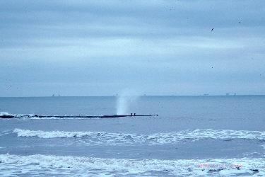
9. Air-cushioned vehicles (ACVs, or hovercraft) and air boats. On the Northern Slope of Alaska, ACVs have been used to move equipment for drilling operations, thus causing minimal impact on the delicate tundra. Studies have shown that ACVs could be used in our coastal wetlands, reducing the need to dig so many canals. They may be especially good for seismographic work. In fact, these are manufactured in New Orleans by Textron Marine and Shell Oil has been using an ACV crew boat for several years at the mouth of the river.
Courtesy Hoover-Freight International, L.L.C.
Drilling in 1-4 ft (Hoover-Freight International, L.L.C.)
Air boats, flat boats driven by airplane engines and propellers, were first used in November 1990 by Louisiana Land and Exploration Company for a seismic operation near Port Sulphur, Plaquemines Parish, Louisiana. They used single engine boats to set up their transects. Then they used a monstrous flat boat with four airplane engines to carry the derrick needed to drill holes into which the explosive charges were placed. All other movement about the site used the typical single engine air boats. After the job was done, there was not a trace that this major operation had occurred. This is much different from standard seismic operations that used tracked swamp buggies that left deep scars in the marsh that eventually turn into puddles, then ponds, then lakes!
LL&E air boat working on a seismic operation in Plaquemines Parish, 1990.
Photo taken immediately after the air boat above passed, showing no damage to
the marsh.
Potential problems: Will ACV and air boat use really be nondestructive to the marsh? If widespread use occurs, regulations will be needed to prevent wideranging travel over the marsh with potentially unresearched, long-range negative impacts.
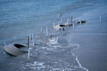
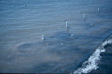
- Sediment trapping. Where water flows and there is ample sediment, the moving water tends to pick up and transport the sediment. As we have discussed, in the past the moving river simply moved sediment to other areas of the coastal wetlands and deposited it. Today, most of it moves into the Gulf of Mexico and is “lost” to coastal restoration. Several devices have been used to trap the sediment, either by a) stopping it as it moves along (like a strainer), and b) causing the water to slow or stop, allowing the sediment to settle out.
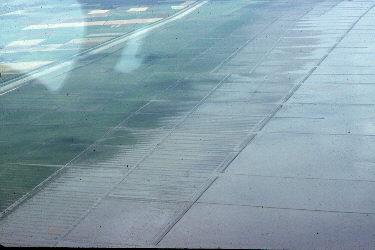
- Terraces: In southwest Louisiana, the Department of Natural Resources constructed Sabine terraces - square walls of rocks, with gaps at the angles. The concept is that water will flow in (by currents or tidal activity), lose its motion, and drop its sediment load before leaving. Note in the photo below the huge scale (see the relative size of the working backhoe).

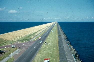
B. In the 1950s and before, the Dutch used dikes to hold back the seas from their low lands. Here is a photo taken in 1958 – North Sea to the left and the Zuider Zee to the right.
Photo by Julian H. Thomas, 1957
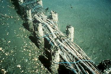
For the last several of decades, the Dutch have used a system of fences in the Wadden Zee that have created marshes that protect their dike and increase productivity in nearby waters.
The system is simple:
1. Fences of limbs are constructed with openings that allow sedimentladen water to enter.
2. As the tide changes, sediment in the water settles against the fence, thus building up the bottom. Another way the fences work is that their mere presence stabilizes the water around them causing sediment to settle out.
In Louisiana, projects in the LaBranche Wetlands of St. Charles Parish, several marshes in Jefferson Parish, and in Pass a Loutre Wildlife Management Area at the mouth of the Mississippi River have had positive effects.
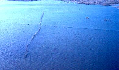
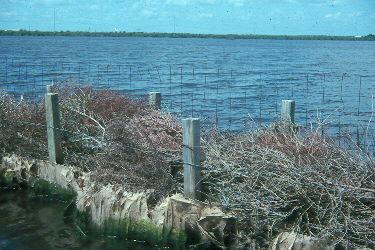
The LaBranche Wetlands project took advantage of sediments that are blown into the marsh during storms or that wash in during the relatively small tidal changes. Also, some sediments come from organics produced in the marsh itself. This was a test site being studied by Dr. John Day and his students from LSU in December 1986. They initially made their fences by driving posts into the marsh floor, cutting branches from nearby forests of blackwillow and tallow, and weaving those branches among the posts. This was very labor intensive and had to be done during the winter when water was low, leaves were off the trees, and the majority of the sediment was in the marsh (and it didn’t hurt that alligators and cottonmouths were inactive). Several configurations were tried (all were between the I-10 and the lake between Kenner and the Bonnet Carré spillway):
-several parallel fences (this could be seen from the I-10 at mile marker 215).
-V-shaped fences.

-X-shaped fences.

An improvement came when it was decided to use Christmas trees. Allen Engsminger and Bob Thomas were having coffee in the LSU Union with Dr. John Day, the scientist who brought the sedimentation fence technology to the United States from the Netherlands. Dr. Day was discussing how tiring it is to use woven willow branches, and someone said that it would be great to use Christmas trees that could be handled easily and would function well. Dr. Day acknowledged that it is a great idea, but that he could never get the trees. Bob Thomas said that the collection of trees is something the Louisiana Nature Center could do easily. Soon, there was a plan in place to have citizens of Orleans and St. Charles parishes donate trees. The citizens delivered trees to a parish government site in James Business Park in St. Charles Parish and to the parking lot at the Louisiana Nature Center in Joe W. Brown Park, eastern New Orleans. Over 7,000 trees were collected the first year (1987-88). The next year, American Waste, holder of the garbage contracts for local parishes, played a major role in collecting over 7,000 trees that were transported to the research site by the Louisiana Department of Natural Resources, and put in place by Dr. Day and his students, and the project was directed in St. Charles Parish by Gretchen Benet.
In 1989-90, 14,000 trees were collected, and by the eleventh year of the program, over seven miles of Christmas tree bins/fences were in place with over one million trees used, spread across projects in 13 Louisiana coastal parishes (Jefferson Parish alone had used 644,000 trees).
The advantages to using the sedimentation project include:
- wetlands were being saved and/or protected,
- Christmas trees are readily available during the winter,
- each one is very dense (as opposed to moving many willow branches to equal the same sediment capturing capability),
- the trees are easy to handle for the research team,
- outstanding cooperative effort among the public sector (St. Charles Parish, Jefferson Parish, State of Louisiana, U.S. Army helicopter corps), private sector (American Waste, Texaco), not-for-profit (Louisiana Nature Center), and scientists (Dr. Day, his students, and LSU)
- public participation, such as individuals delivering their trees and untold numbers of volunteer hours were donated,
- saving landfill space by sending the bulky Christmas trees to the wetlands.
The way the plan was implemented was relatively simple. Two parallel rows of posts were placed in the marsh. These were surrounded by hog-wire, forming a container that was then filled with trees. Wire was placed over the top to prevent the trees from floating out during storms. This was a successful project.
A new approach, first used in 1992 in Jefferson Parish, is to use Christmas trees to fill in existing canals and abandoned well sites (key holes). Once the open area is filled with trees, any sediment that enters is caught on the trees and the trees greatly slow the movement of water, so sediment in the water gradually settles out.
Potential problems: Scientists should monitor these projects to see if the change in location of sediment impacts the adjacent waterways.
11. Barrier island and beach projects. High, stable dunes protect beaches and marshes. Louisiana, however, has no large dunes due to 1) the relatively high rainfall (about 65 in/yr) that keeps the sand too wet and 2) a high content of ground mollusk shells that are much heavier than sand. The nearest high dunes are found in drier areas that contain pure silicate sands like Padre Island, Texas, to the south, and Horn Island, Mississippi, to the east.
A. Construction or reconstruction – For years and years, we tried to stabilize our barrier islands using hard engineering (see “causes” section above). In our human memory, we knew the islands as low, sparsely vegetated zones that were always subject to the whims of the sea. The late Dr. Shea Penland looked at the historical geology of the barrier islands and learned that they once where much higher and heavily vegetated, much like Horn Island (off Biloxi, Mississippi) is today. The new “managed” barrier islands may be more stable over time.

In Terrebonne Parish, there are two projects that were hoped to be successful examples of how barrier islands can be reconstructed or can be stabilized (for a period of time!) via reinforced leveeing techniques, or simply using piles of rock.
One was the reconstruction of Wine Island, located near the mouth of the Houma Navigation Canal. This was a CWPPRA project from the early 1990s, that has had to be restored several times as the sea moves the sand out of the stone circular wall. It was filled by the Corp of Engineers as they dredged shipping channels and place the soils there as part of their beneficial use plan. The trouble is that they used what they dredge with no analysis of the types of soils and no selection for durable sands, so they have used fine sands that immediately wash away.

Wine Island, taken after a recent restoration in
2000, photo RAThomas.
By 2007, most of the sand was gone with a small amount still visible outside the stone ring.
Wine Island, 2007.
It was refilled once again. Unfortunately, Mother Nature had other plans. By 2012, due to the effects of Hurricane Isabel, the dredge materials had moved outside of the ring of rocks and eventually disappeared as a result of waves, currents, and storms. Today (2020), the rock ring is still in place, but beneath the surface of the Gulf. Most believe it will be a waste of money to pump more sand.
Another CWPPRA projects was done in 1998 on East Island (the eastern-most piece of the Isle Dernier barrier island chain), where a huge levee was built and filled in to a height of some eight feet above sea level. In 1999, it was planted with many species of naturally occurring plants. This project stabilized East Island for the next 10 years or so. East Island and Trinity Island were separated by a space called the New Cut. Over time, the sand transport system moved East Island sand naturally to the west, New Cut was filled in, and East and Trinity islands merged, and are now named Trinity/East Island. Prior analysis showed that the two were losing about 54 acres per year; post-merger, this rate has reduced to 14 acres per year and the islands are expected to be viable until 2065 or beyond.
A similar project was established on Fourchon Beach, Lafourche Parish. For some years, a rather simple beach protection technique was in use on Fourchon Beach (part of the Caminada Beach system just north and west of Grand Isle). Aggregate filled fibrous containers (that look like pillows and are called boudin bags [because they look like “boudin,” a Cajun sausage]) were placed along the beach. These have an apron of material (called ergomat) that extends toward the Gulf to keep waves from washing under the pillows and collapsing them.

It appears that this system helped (except that Hurricane Andrew washed many of them away), but the island continued to narrow, causing tremendous concern since Port Fourchon’s developed area (behind the barrier island) is the epicenter of activity for servicing offshore oil and gas production.

Fourchon after Hurricane Andrew. Note the disarray of the
boudin bags and absence of a beach.
To resolve the problem, Fourchon implemented a new system in 1994 that was patterned after the successful project on East Island (Isle Dernier). A 10 ft high rectangular ring-levee, fronting along the foreshore where the boudin bags reside, was constructed and filled with pump sand. This elevated beach is less susceptible to the ravages of wave action on the beach face and the barrier beach seems to have been saved (at least for the time being).
Boudin bags, ergomat, and breakers at Fourchon Beach.
Fourchon barrier island after it was leveed and filled, 1994.

The front of Fourchon barrier island with boudin bags and ergomat.

Healthy vegetation behind the refurbished Fourchon barrier island development.
Here is a synopsis of the Caminada-Moreau Headlands Back Barrier Marsh Creation project (note: there have been alterations along the way, and they will continue, so you will find differing numbers if you read many sources – even the name of the project varies depending on the source; the numbers used below seem to be reasonable and give you context on the size of the operation).
Elmer’s and other areas in the Caminada-Moreau Headlands had become very low in elevation, and had been moving inland for years. There were a number of exposed marsh mats, with protruding black mangrove stumps, indicating that what was now on the beach front was originally on the rear of the barrier island. There was fear that the existence of a persistent wash over (see photos below) would result in Elmer’s being cut in half, so a massive enhancement project between 2013 and 2015 placed a lot more sand on the beach, and vehicle travel along the beach is no longer allowed. It is still a very nice walk and worth every minute (hour) it takes to travel.

This is where cars used to be parked. It is a wash over spot without rushing water.
One could drive east or west down the beach under these conditions.
Photo by Bob Rogers.

This is the way the parking lot used to be when there was a storm, especially during
Hight tide. A wash over in action! Photo by Bob Rogers.
It was at its time of construction the largest, costliest project in the state’s coastal plan accomplished by the CPRA – some 8.7 million cubic yards of sand was spread along 13 miles of beach at a cost of $215.9 million – restoring and enhancing about 800 acres. The very high-quality sand is from Ship Shoal, a submerged beach (or sand accumulation from many former beaches) from a time when sea level was much lower than today, now located about 40 miles southwest of Elmer’s Island (27 miles southwest of Belle Pass at the mouth of Bayou Lafourche near Port Fourchon). Scow barges were loaded by cutter dredges over the shoal, moved to the west end of the Caminada-Moreau Headlands at Belle Pass, then piped all the way to the vicinity of Caminada Pass at the east end of Elmer’s Island. As the work progressed toward the east, sand was poured from the pipes onto the beach, then moved about by bulldozers to create a higher, more efficient barrier beach.

Students standing on the sand dispersal pipe near its beginning at Fourchon Beach.
Port Fourchon in the rear, and note the pipeline in the center of the beach
to the left that forks to three pipes that deliver the sand. Note how wide
the beach is to the left as opposed to the right where it has progressively
moved north into the estuary.

Beach at Elmer’s Island separating the parking lot from the Gulf.

The east end of Elmer’s Island at Caminada Pass – top is
before the beach nourishment, bottom is after.
The purpose of and justification for the expense and effort were:
- To halt what had been an approximately 45 foot per year movement of the barrier island toward the marshes.
- To protect Port Fourchon, surrounding marshes, and Louisiana highway 1 from storm damage.
- To enhance beach feeding and breeding sites for shore birds, especially the endangered piping plover, least terns, and red knots.
Critical portions of the beach nourishment took place when shore birds might nest and their nests be damaged. In order to discourage the birds from using the beach under construction at the time, contractors built windrows that appeared to deter nesting by these birds in the construction zone. By law their presence would have halted the project. The windrows were eliminated as construction progressed.

Bird nesting discouraging windrows. 4-10-16.
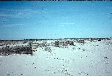
B. Plantings and Fencing - The best techniques to stabilize barrier islands are those that mimic and help nature. Planting naturally occurring species of plants on beaches and low dunes gives Mother Nature a boost. The plants' roots hold the dunes together and the vegetative part of the plants "catch" the blowing sand and cause dunes to build.
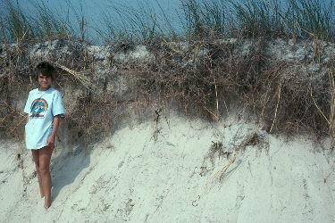
After a storm, dunes are often partially washed away, revealing the extensive root systems that hold them in place (sea oats on Horn Island).
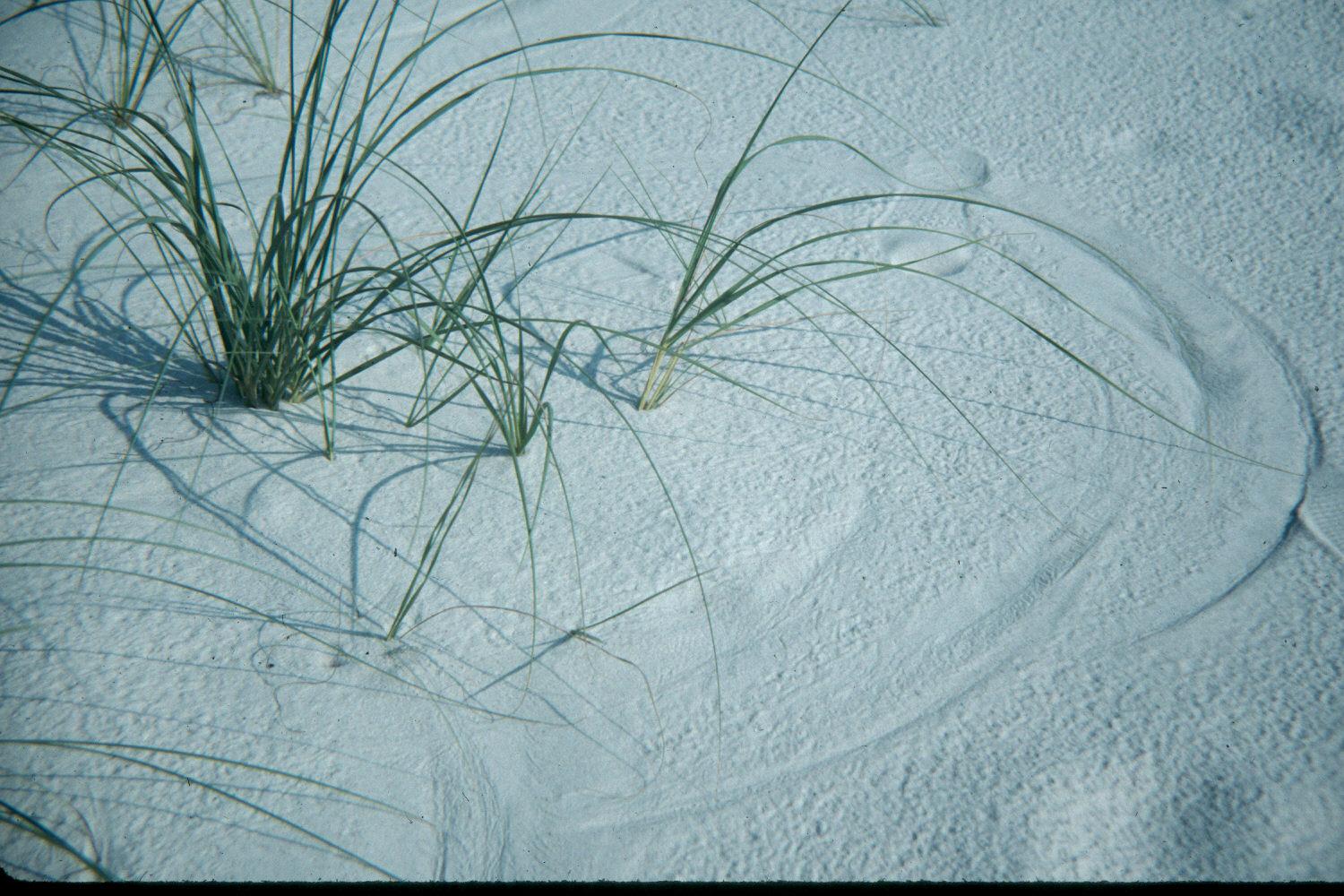
A dune starts with a few plants (sea oats). The wind blowing the
leaves that touch the sand leaves “sand circles.”
In this photo, a few plants on the Grand Isle beach are capturing wind blown
sand and starting a sand dune.


Planting projects, in conjunction with fencing, have been successful.
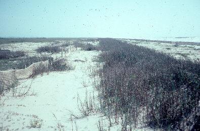
Fourchon beach with plantings on dunes and fencing.
In sea oats, for example, the plants grow "up" as windblown sand collects around their bases (see Horn Island photo above). This is an unusual trait and is the reason that only a few species of plants are successful growing on and among sand dunes (others get covered and die). The importance of the sea oats for dune stability (and thus allowing beaches to protect valuable wetlands to the rear) is why all coastal states have laws preventing people from collecting the beautiful seed heads of sea oats. If the seed heads are taken away for ornaments, new sea oats don't grow and the dunes quickly disappear. The following photo explains why people are always tempted to pick sea oats seeds – they are lovely.

Navarre, FL.
Be careful the next time you visit your favorite beach. Just walking over the dunes causes them to erode. If you go to a beach house, use (or make) movable “steps” that protect the dunes. They can be stored when no one is at the house.
It is also very effective to place fences (picket, wire, cloth, plastic sheet) and other such things (Christmas trees, bales of hay, etc.) on the beach. They catch windblown sand and promote the formation of dunes.
C. Beach nourishment (called soft engineering) - This is where sand is pumped onto the beach area, either from existing offshore sand deposits or after being barged in. This is very expensive. After Hurricane Juan, the Corps of Engineers spent $6 million nourishing Grand Isle's beach (again!).
There have been proposals to mine sand from offshore deposits to be used to nourish beaches. This should be plenty controversial, but has potential.

Sand is being pumped from offshore (at taxpayers’ expense) to replace an eroded beach that resulted from poor placement of a jetty. Gulf Shores, AL.

A closer view. The birds love the free meal.
If it is totally lost, sand can be shipped in from other regions.

Sand delivered by dump trucks (at taxpayers’ expense) to replace dunes washed away in Hurricane Danny (Navarre, FL, July 1997).
Both of these are very expensive processes and should be carefully considered before being attempted.
D. Breakwaters and other Hard Engineering that works - Where harsh wave action is destroying barrier islands, many projects have used boulders and other forms of rip rap to protect the shore. Hard engineering is the use of structure (concrete, rocks, wood, etc.) to protect beaches against the relentless movement and pounding of water.
1. Breakwaters are structures (or piles of rocks) placed offshore that break the wave energy as it approaches shore.
Sunken barge breakwaters, Fourchon, LA.

Rock breakwaters, Grand Isle, LA.
2. Shoreline revetments: As mentioned before, oil companies have placed large boulders along water’s edge on barrier islands such as East Timbalier. The concept was to allow waves to break against the rocks instead of hitting sand and washing it away. These failed due to their repelling wave energy that rebounded and removed sand in front of them, making the slope of the bottom steeper and causing the shoreline revetments to sink below the surface.
3. Tires: There is much work going on now regarding the use of automobile tires, old cars, etc. A local engineering firm used a technique whereby they placed tires (cut in half) in stacks that they say optimize the collection of moving sands in the water. Some say that this system changes the longshore movement of water and does little good for the beach.
4. Concrete donuts: A Tulane engineering professor developed a concrete "donut" that could be placed in shallow water where it was said to capture moving sand. These were used on the north shore of Lake Pontchartrain at Fontainebleau State Park and were used in Grand Isle in 1993 to test their feasibility for stabilizing barrier islands (funded by Freeport McMoRan). The late Dr. Shea Penland, Louisiana’s dean of barrier islands, did not believe that these donuts are effective.
The above three photos were taken on Grand Isle, April 1993.
-Potential problems: Discussed in text above.
Rule of thumb: Barrier islands are and will always be dynamic, moving elements of our coast. This gradual movement is part of the natural order of geologic processes and cannot be controlled.
Dilemma: Barrier islands are very important as boundaries of lagoons and estuaries, yet people's use for houses, roads, etc., on these dynamic structures is hastening their loss. Anyone who builds a structure on any piece of land surely doesn't want to see the land move away and leave the structure in the water!
Future: The eustatic rise in sea level will eventually submerge the barrier islands. This is geologically cyclical. Our barrier islands are only several thousands of years old now (some are only 300 years old) and have come and gone in the past.
12. Marsh management (now called hydrologic restoration)
Although a great deal of what humans do in the marsh can be labeled management, the term marsh management refers to a particular school of thought on how to maintain wetland quality. It is embraced widely by landowners. The techniques used depend of the management objective: to save marsh, maintain wildlife, preserve and use mineral and/or property rights, define property lines, protect liability, protect vegetation, etc.
Several techniques are used for marsh management:
A. Impoundment: an enclosed parcel of land or water, called fastlands. Biologically speaking, impoundments are believed to reduce saltwater intrusion, reduce landloss, improve fish and wildlife habitats, enhance vegetation, and keep marsh from drying and soil from cracking. Some types of water control structures that are used in impoundments are:
levees: Keep marsh water impounded.
earthen plugs: Prevent water flow through canals and other openings.
weirs: Designed to maintain water level in the marsh behind them. Most are 6 inches below average marsh level. If water level drops in the marsh, the soil behind the weir remains wet. There are several types:
-fixed-crest weir: These are rigid structures with the top fixed at a certain level, i.e., it cannot be adjusted.
-variable-crest weir: These are adjustable, usually with boards that can be removed or added.

-slotted weirs: This type of weir has vertical openings that allow marine critters to move through even when the functioning weir is regulating the flow of most of the water.

flap gates: Allow the water to flow only one direction. Freshwater can flow out, but saltwater cannot enter less salty marsh. Flap gates may be opened (as shown in the photo below) or closed.
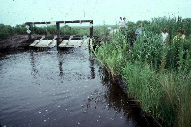
Photo by Richard Carriere
Note: If improperly designed or managed, impoundments may submerge marsh grasses and kill them, converting marshes to open water. It is frequently advisable, also, to drop the level of the marsh to encourage reseeding of marsh plants.
B. Canal backfilling: filling in old canals to stop their disruption of the marsh ecosystem. This is an expensive endeavor, but leaving old canals and keyholes open is costly to the health of the environment. With today’s knowledge, it makes sense that those who speculate for profits should be required to repair their damages.
C. Shoreline stabilization: using anything from plastic sheeting to rocks to protect shorelines from the destructive forces of waves, wakes, and other water movements. In St. Charles Parish, a system of interconnected concrete blocks (called ergomat) was used to stabilize the mouth of a pipeline canal where it emptied from the LaBranche Wetlands into Lake Pontchartrain.

- Wave dampening fences: These are fences, made of many different materials, that are strategically located in places where waves (caused by winds or even boat wakes) are causing damage to an area. In some cases it may be a bank, a marsh, or a swamp that is being protected. In the photo below, a wooden fence was placed to break the wakes of passing boats. Coupled with an active planting program, the fence and new plant growth prevented the wakes from washing away the shore and merging the canal with the open water to the left.
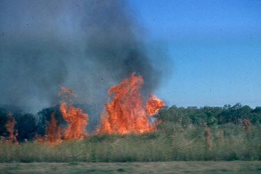
E. Marsh burning: enhances new vegetation growth and nutrient recycling. In some instances, marsh fires destroy biomass needed for marsh building, but these events are unusual.
F. Aquatic weed control: prevents dominance by a few species. This has been done using machines that chop up the vegetation and throw it on the bank and using herbicides that kill the plants.
A novel approach has been the use of insects. In the 1960s, the Corps of Engineers introduced the Alligator weed Flea Beetle into the St. Johns River in Florida. This beetle bores into the stem of the alligator weed plant and kills it. The flea beetles have spread throughout the South and, by killing the stream-clogging alligator weed and other freshwater marsh plants, have participated in the loss of incredibly rich habitat for alligators, fur bearers, and waterfowl. There are usually trade offs!

Alligator weed Flea Beetle.

Alligator weed eaten up by Alligator weed Flea Beetle.
In the mid-1970s, the Louisiana Department of Wildlife and Fisheries introduced the Hyacinth Weevil, a native of South America, into the Atchafalaya River basin. This weevil feeds on the leaves (evidenced by little yellow spots) and stresses the plants enough that they do not flower. The flowerless plants produce no seed, but they still reproduce by forming daughter plants (asexual). Also, hyacinth seeds remain viable for 20 years or more, so there are constantly more plants showing up.
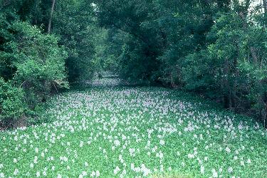
A water hyacinth choked bayou.
Water hyacinth that has been attacked by the Hyacinth Weevils.
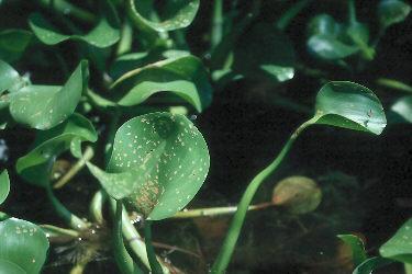
Note the tiny brown dots on the leaves.
G. Revegetation: actual planting of new vegetation where it has disappeared.

Milton Cambre and his plantings in the LaBranche Wetlands.
Grass plantings on a barrier island. Intended to stabilize the sand.
H. Use of old pipelines: Dr. Paul Kemp, formerly of the Coalition to Restore Coastal Louisiana and now with the National Audubon Society, originally suggested that the network of abandoned pipelines extant in the marshes could be used to pump sediment to critical spots. This is presently being studied.
- Wildlife control: Muskrats, and especially nutria, can eat vegetation faster than it can either grow or be planted. During the spring and summer, these rodents eat the base of the vegetative portion of the grasses, allowing the tops to float away. They also gnaw to tops of the roots, where the meristem is located. Since the meristem is the source of new growth, this causes the plant to die and the result is usually open, unvegetated water.
During winter, nutria eat the roots with equally devastating results.
Nutria are especially fond of seedling cypress trees. In order to protect new plantings, ecologists are using various products (called NEDs, Nutria Excluder Devices, a take-off on TEDs, Turtle Excluder Devices) to protect the seedlings (such as plastic sheaths [these seem to work best], wire sheaths, and exclosure fences).

A Nutria Excluder Device (NED) at Turtle Cove Environmental Research Station, Manchac.
Geese can also have very negative impact on large growths of marsh when they are here during the winter months. They also eat the roots.
An excellent idea, originally pushed by the Louisiana Nature Center in New Orleans, is to eat nutria. The first two NutriaFests were held in 1993 and 1994 at the Louisiana Nature Center during which there were nutria cook-offs (this was continued at the Swamp Fest at the Audubon Zoo and returned to the Louisiana Nature Center in 1998). Nutria meat is quite tasty, has no wild taste if cleaned properly, accepts seasonings well, and is leaner than turkey.

Enjoying nutria (cooked by the late Art Cormier, left) for a
National Geographic Explorer video.
NutriaFest also advocated redeveloping a nutria fur industry. This full-length nutria coat was purchased at Saks 5th Avenue, and is elegant and warm (and helps rid our coastal wetlands of destructive, alien nutria).

For this industry to help curb the destruction wrought by nutria, there must be a market for everyday, affordable winter wear, as one finds in the nutria’s native land, Argentina.
New Zealand has a horrific problem with their alien brushtail marsupial possum, introduced from Australia about 150 years ago and now estimated to have a population in excess of 70 million. The Kiwis have mastered the art of finding uses for the furs and pelts, including gloves, scarves, hats, sweaters, slippers, novelty items and much more. The product is called eco-fur, since its use is deemed good for the environment. Brushtail possums consume their plant species as well as native birds and other small vertebrates.
With respect to those who love all living creatures and don’t think any should be trapped or otherwise harmed, those who believe nutria must be removed base their belief on their obvious destruction to the coastal ecosystem and the harm they do to all the native species, both plant and animal, that live there. The mere act of protecting nutria has the unintended, but very real, consequence of devastating harm to the natural ecosystem.
Potential problems of marsh management: Negative impacts of the use of levees in marsh management include their exclusion of some vegetation, fish and/or wildlife; changing of natural water movement; and restricting movements of some marine organisms. Many believe that the latter is the most important negative.
13. Mitigation banking. This program derives its name from the way we use banks. When we want to save money, we place our money in one place - our bank. A mitigation bank is a designated place where someone can invest money to improve the quality of wetlands. This happens when someone wants to in some way change a wetland (drain, fill, change the vegetation, dredge) in order to accomplish some project. If the project is deemed important enough, and the affected wetlands are deemed unimportant enough, the project may be approved with the qualification that another wetland be improved. Normally, a "deposit" is made in a mitigation bank. The largest and oldest in the Mississippi River Delta is the Fina-LaTerre Mitigation Bank south of Houma. Someday that very important wetland area will be fully functional and yet another mitigation bank will have to be formed. There are many places where mitigation banks will remediate problems in our coastal wetlands, and we must assure that they are chosen wisely for the good of the entire ecosystem.
---Potential problems: People who oppose the concept of mitigation banking fear that the wide-spread and acceptable use of this program will make permitting agencies more lenient with requests to alter wetlands.
14. Removing Nutria. As has been discussed in 12I above, nutria have had a devastating impact on coastal wetlands. Since this is an alien species (from Argentina), there is no biological reason to protect it. We should do everything we can to extirpate U.S. populations, including exporting meat, eating them ourselves, and wearing their skins. In 2002, a bounty of $4 ($6 in 2020) was placed on nutria, with a target of eliminating 400,000. It has been very successful, with more activity by landowners to protect their land than as being sport driven or simply people seeking extra money.
---Potential problems: None!
SO WHAT CAN WE, AS INDIVIDUALS, DO?
The following are a few thoughts:
Develop a sense of stewardship; encourage people to care for the land.
Save what we can.
Slow the process as well as we can then develop techniques for replacing the values of wetlands.
Encourage technologies that replace wetland values, both economic and cultural.
Do everything we can to get all public agencies involved in coastal wetlands to operate in a coordinated fashion.
In the marsh zone (below Belle Chasse, Houma, and Thibodaux), people live on the old natural ridges. There are two things we do to protect ourselves from saltwater invasion:
1. Build levees.
2. Install flood gates to hold back the intrusion of salt water. Canals give saltwater and floods new entries.
The way we have accomplished the above is through the implementation of development corridors. The classic is the stretch between Belle Chasse and Venice where the highway and living areas are protected by levees. Since high waters are prevented from spreading over the entire zone by the levees, this development corridor causes unusual flooding to the west.

Chauvin, LA, development corridor.
Consider ethical questions: If it will take $5 billion to save $50 million in economic value, should we do it?
We will have to learn to live differently. We will be forced to make decisions that we have always put off before. For example, we may well have to displace Morgan City or New Orleans. We may not be able to save Grand Isle. People who live in many coastal areas may have to be denied subsidized flood insurance. We may be forced to change the main channel of the Mississippi.
What if we do lose the fisheries? What then? If the worst case scenario does occur, what will the displaced people do? In terms of this looming catastrophe, is New Orleans worth saving? Cut Off? Grand Isle? South Louisiana? Do we have the will to solve these problems?
After all this discussion, there are three truths:
1. There will always be a coastline.
2. There will always be a mouth to the river.
3. Our wetlands will never be restored to what they were. In fact, we will not restore the disappearing saline marshes. They will be open, shallow bays with islands of grass.
Dr. Woody Gagliano (1994) offered some suggested steps to help save the coastal wetlands:
1. Save the ridges - the high ground. This is also true for the barrier islands.
2. We must establish a line of defense where we try to stop the loss. These places may be identified as where the loss is now occurring.
3. We should establish some new oyster reefs that will add grit to the system so that beaches can be made. They will also operate as breakwaters.
4. Expand the delta in critical plumbing zones.
a. Balize - spread soil over the adjacent shelf.
b. Atchafalaya - allow sediment to exit Wax Lake Outlet.
5. Build Davis Pond freshwater diversion canal.
6. Maintain the banks of the waterways (GIWW, Barataria Navigational Canal, Houma Navigational Canal, MRGO, etc.).
7. Use dedicated dredging. Move the dredged soil through pipelines to critical places in the marsh (using existing and new pipelines).