What Causes the Loss of America's WETLAND?
THE COASTAL WETLANDS ARE ERODING
As a Native American, my belief is that when the place where I live sinks under the sea, the Houma Nation, my tribe, ceases to exist.
- Steve Cheramie, 1999
WHAT IS CAUSING COASTAL EROSION IN LOUISIANA?
One would hope that if the cause of Louisiana's coastal wetland loss is simple, the solution might also be simple. Unfortunately, this is not so. Oh, yes, each of the many causative factors is rather simple, but for any given location, different combinations of factors are at work and each different combination demands different solutions.
The following are 15 of the problem causing factors that we recognize today.
1. Subsidence. Subsidence is simply a decrease in the level of the soil's surface. The level of the soil's surface is recorded relative to mean sea level (MSL), that is, a house slab level may be recorded as -1 MSL, meaning that it is one foot below sea level. The actual scale used today is NGVD (National Geodetic Vertical Datum), a fancy name that is equivalent to MSL. The old measure for stating the height of any surveyed object was Cairo Datum, based on a benchmark at a Corps of Engineers facility in Cairo, Illinois. That benchmark was 20.43 ft above MSL, so one had to always subtract 20.43 from each Cairo Datum number to equate it to MSL. Aren't you glad they changed? Don't you wonder why they ever did it that way?
Many people seem to think that subsidence is a recent phenomenon that is quite simply a problem associated with house construction. They know that there are areas where, over time, the soil will recede below the slab, driveway, and sidewalk, causing cracking and the need to add more soil. Actually, subsidence began when dirt was "invented." It has always occurred and it will continue as long as soil exists! The major effect of subsidence along Louisiana's coastal zone is that as the soil subsides, the sea creeps further inland, covering valuable resources and places where we live.
There are two categories of subsidence:
a. Surface subsidence: This type of subsidence, i.e., soils near the surface sinking, was not a problem in the not too distant past. Though subsidence has always occurred in the delta, each year's high water would overtop the low, natural levees and spread new soil across the river's floodplain. In most places, the river added more soil than that which had subsided during the year. This resulted in net growth of the delta, so subsidence was not considered a villain, but just a natural process.
What causes surface subsidence? 1). When soil particles fit closer together, they occupy less space so the surface sinks or subsides. The particles are very rough edged, so it is easy to imagine how this might happen. Envision a family activity such as working on a jigsaw puzzle. When you lay out all the pieces, the puzzle covers the entire table.

After being put together (=making the "rough edges" fit closer), the puzzle occupies much less space. The same is true of soils.

2). When water is removed from soil, the spaces once filled with water now filled with air, so the soil particles move closer together and the surface subsides. 3). When organic matter (such as leaves, peat, etc.) decomposes, soil subsides as particles move into the spaces formerly filled with organic matter. 4). When plants die and their roots decay, soil subsides as the particles move closer together.
- Geologic subsidence: This is subsidence caused by events deep in the earth. The delta consists of great quantities of sediment laid down over a great layer of salt (called the Louann salt) located some five miles below the surface.

Huge chunks (fault blocks) of this salt (usually in the shape of polygons) subside, thus causing the surface to subside. Below a line running between New Orleans and the northwest side of Houma, the rate has been 3-4 inches per century. This is a phenomenon that is out of human control.
There are also numerous other fault zones along the northern coast of the Gulf of Mexico.
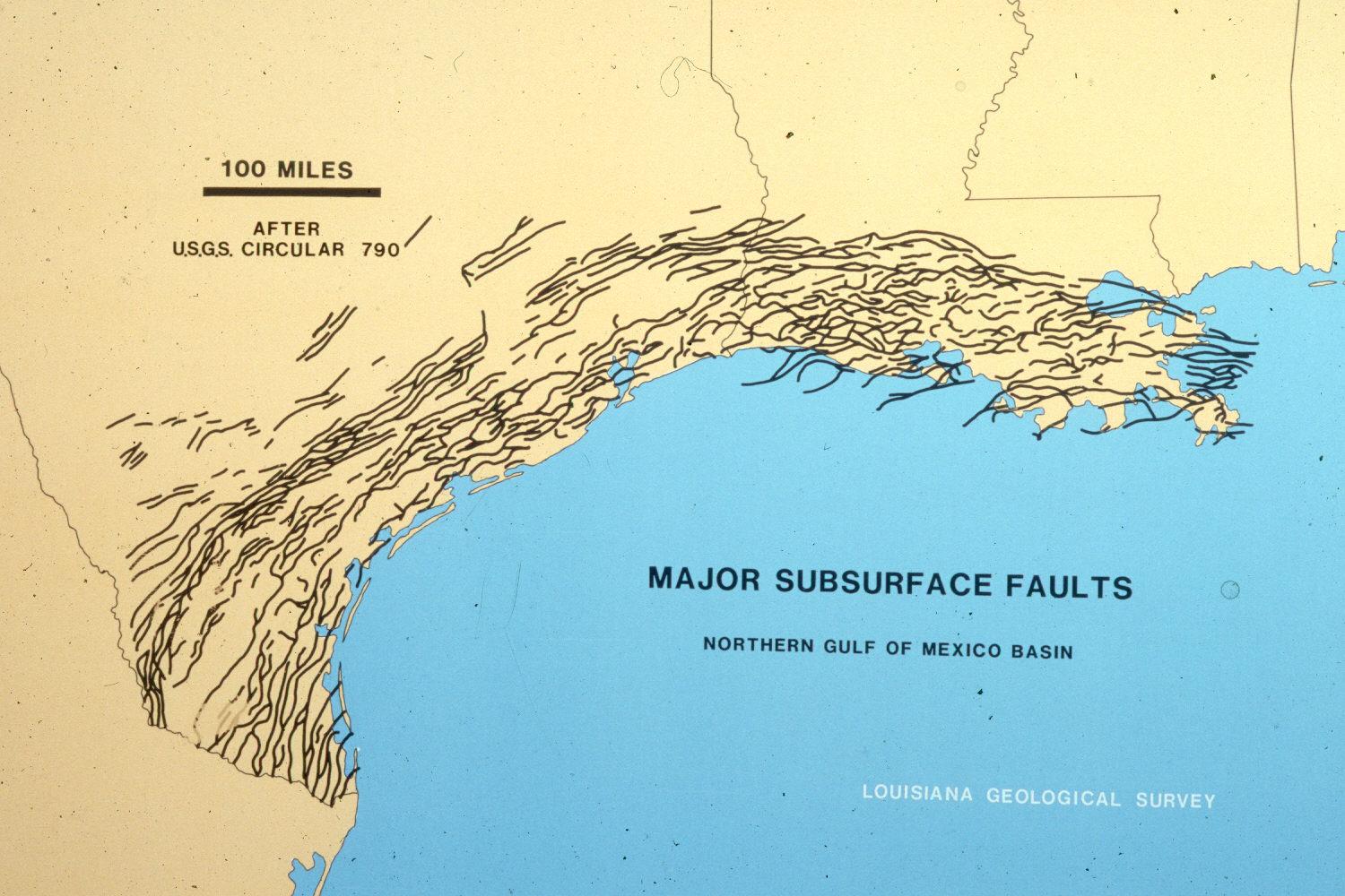
There has been discussion in 2003 about the impact of faults along Louisiana’s coast. Woody Gagliano, the “father” of coastal erosion in Louisiana, contends that possibly half of the loss of wetlands in the latter half of the 20th Century is due to faults in our muddy coastal areas. As evidence, he notes the rather rapid formation of lakes that have straight margins (one would expect rounded or jagged edges if storms were causing the loss of wetlands).

Another coastal scientist, Robert Morton of the U.S.G.S., agrees that faulting is an issue, but he thinks it is caused by the extraction of billions of gallons of oil and trillions of cubic feet of natural gas. The removal of these products causes the earth to sink into the new openings. He cites as evidence that the greatest land loss was coincident with the period of largest oil and gas extraction, the 1960s-70s. As these activities wane, so does the rate of wetland loss.
As with most suggestions, the plot thickens and complexity increases!
2. Extraction of minerals. For years, it was contended that extraction of minerals plays a roll in coastal wetlands loss. Many concede that removal of sulfur has had a negative impact, primarily due to the rather shallow deposits.
Oil and gas is another story. Many denied the plausibility of such deep extractions having an impact at the surface. New discussion (see Robert Morton’s ideas above) indicate that oil and gas may be a player in wetlands loss, especially since the overlaying sediment is rather soft alluvial soil that is apt to shift and/or collapse with increased weight.
3. Levees. Before levees, there were predictable variations in the alluvial environment - plants and animals (including native humans) adapted to and lived by those cycles.
Each spring, our mighty Mississippi River swells as a result of melting snow and spring rains in its drainage basin 1.25 million sq mi, or 41% of the continental U.S. (31 states and two Canadian provinces). In days gone by, the river frequently swelled above her natural levees and spread out across her flood plain, becoming a very wide river and flooding much of the area between New Orleans and Lafayette.
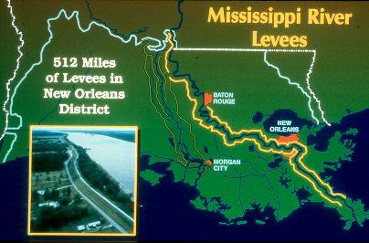
Since the founding of New Orleans in 1718, people have tried to control flooding by building levees to protect their property. Originally, this was not done on a grand scale, but blockbyblock or plantationbyplantation.
The great flood of 1927 was the final straw. Louisiana citizens demanded that Congress allocate money to build a levee parallel to the river that would protect their property from future flooding. Congress mandated that the U.S. Army Corps of Engineers provide protection and a system of levees and upriver structures were built. Yea! Louisiana was now safe from floods and we could expand our settlements and associated facilities such as highways, railroads, industrial plants, power lines, etc. Life was wonderful and all rejoiced!
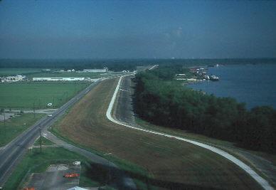

But guess what! As discussed above, soil in coastal Louisiana continued to subside! In fact, subsidence increased because of the absence of water in the soil and faster decomposition of organic matter. Before the humanmade levees, the river would flow over the natural levees and spread out and deposit millions of tons of new soil in coastal Louisiana each spring. It deposited so much, in fact, that the coastal wetlands of the Mississippi River Delta grew and expanded.
Today, the levees prevent the sedimentladen water from reaching the wetlands, and subsidence continues, and the wetlands disappear as land becomes open water. We saved ourselves from floods, but we also directed the valuable sediments away from the coast. We didn't know that our valued levee protection would cause the loss of our coastal wetlands.
We traded periodic river flooding for permanent coastal flooding.
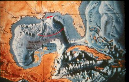
- We've reached the edge of the continental shelf. The logical question: Why doesn't the Delta just continue to grow into the Gulf? The Delta has reached the edge of the continental shelf. The river's sediments are being deposited into the Gulf's depths, and they are not returning to the shore. If the Mississippi River is to build new wetlands, it must change its course to flow toward the available continental shelf.

5. Reduction in available sediment in the river. As discussed in the MRD 8 notes, sediment in the river varies greatly from year-to-year. Recent years have shown a trend toward reduction.
Presumably, much of this decrease in sediment load was a product of upstream soil conservation activities such as dams and soil erosion projects. Farmers in the heartland of America value their topsoil and use many erosioncontrol techniques to prevent its loss. This is good for them, but bad for us because we have less soil to enrich our coastal wetlands.
We don't know how much soil was transported in 1066, 1492, or 1776, and we can't project how much will be moved in 2050, but we are sure that big changes can definitely occur.
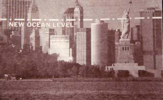
6. Sea level rise. No, it won’t look like this (from Sun magazine):
There is a finite amount of water on earth, but the term sea level is a relative phrase and it can change a) as the volume of the ocean basins shift with tectonic activity, b) lowering of the coastal margins through subsidence, and c) where and how it is stored (such as changes in the amount of water vapor held in the atmosphere or the size of glaciers). Tectonic changes don't appear to be at issue today, so let's first discuss glaciers.
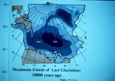
During the height of the ice ages (the Pleistocene), huge amounts of ocean water was trapped in glaciers, so sea level dropped and more land was exposed. There were three major glacial advances during the Pleistocene. During periods between glaciations, the ice caps melted and sea level rose, perhaps as much as 600 ft. About 18,000 ybp (the height of the Wisconsin Glaciation, the largest of the three), the Louisiana coast extended 50 mi further south than where Grand Isle is today (to the edges of the Mississippi Canyon and continental shelf). What is now the habitat of stingrays, sardines, pogie, sea turtles, and dolphins was once the domain of egrets, snakes, lizards, rabbits, and deer – and humans.
The most recent ice sheets began to melt 15,000 ybp. Geologists believe that sea level rose in spurts rather rapidly, but has been somewhat stabilized and has remained that way for the last 6,000 years. In the following figure, "Gulf Coast Biostratigraphy," note that the last column shows sea level variation since the Eocene (last 40 million years). Sea level rise is not a new phenomenon.

The normal, cyclical changes that happen in nature may be quite drastic in their extremes, but they are usually slow, orderly processes that all healthy components of the ecosystem can adapt to and thus survive (see the earlier discussion about the sea level rises and standstills of the Holocene transgression under How Has the System Evolved?). Such is the case with the rise in sea level. It may be, as many say, that the eustatic (worldwide) sea level rise is Mother Nature at work. But instead of the relatively smooth transition (with alternating spurts of rise and standstill) to a higher sea level, we find that the ice sheets are melting faster than they should, undoubtedly due to anthropogenic causes. Atmospheric warming is causing the polar ice caps to melt faster than normal. Additionally, warmer temperatures have caused the ocean's water to expand (steric expansion: as molecules of sea water components are heated, the arrangement of their atoms is adjusted so that they simply occupy more space). The oceans have more volume, consequently they will eventually cover more coastal wetlands.
While examining tidal gauges along the Louisiana coast, it was noted that there was a period between 1962 and 1975 when eustatic sea level rise may have occurred at a rate of 3 cm/yr (Penland et al., 1996: 5). This value is equal to the projections of sea level rise between the Holocene transgression standstills, meaning that what has been termed the 1960/1970 eustatic event was a large contributor to the rapid wetland loss during that period.
What is the most current information on global sea level rise? It seems the numbers change a lot, but they vary often due to the methods and assumptions made by the scientists studying them. The IPCC likes to give them on the basis of what humans do to the rates of climate change. Ranges are good, and in 2020 IPCC is using a range of 12-13.6 inches (30-34 cm) by 2050, and 27.6-44.4 inches (69-111 cm) by 2100.
Sea level rise affects the world's coasts. If you lived on the White Cliffs of Dover that rise some 125 m above the sea, you wouldn't be concerned if told that world sea level will rise 12 inches by the year 2050. [I was speaking to a large audience once and made this statement, and a gentleman in the audience raised his hand, and said, “I’m from Dover, and you need to know that sea level rise does affect us – wave action at the base of the tall cliffs causes the limestone (chalk) to collapse.”]

It has, however, special significance along Louisiana's coastal lowlands. Louisiana is blessed with the most extensive coastal wetlands in America. There is little grade (elevation) change in some areas, and a sea level increase of 12 inches might cover miles of existing marsh. But that's not all! The White Cliffs of Dover are standing sturdy with the water creeping up 12 inches. The marshes of Louisiana, while being assaulted by the sea, are themselves sinking due to subsidence. Current estimations are that by the year 2050, the water along Louisiana's coast will be 30 inches deeper than it is today: the sea goes up, the soil goes down, and we go under!
Relative sea level rise (RSL) is a very important term to understand in Louisiana: We know global sea level is rising and we are constantly adjusting at what rate, and in Louisiana the land is subsiding; relative sea level rise is our concern, and it adds sea level rise and subsidence rates – for years our relative sea level rise has been discussed as 18 inches over 50 years.

The numbers used in the 2017 Louisiana State Coastal Plan predict the following, all referring to rise from sea level that existed in 1992 (they are not linear, and will sometimes move faster than other times):
- Year 50 (2067)
- Low: 1.41 ft
- Medium: 2.07 ft
- High: 2.72 ft
- 2100
- Low: 3.28 ft (1 m)
- Medium: 4.9 ft (1.5 m)
- High: 6.49 ft (1.98 m)
OUR GREATEST DANGER LOOMS FAR, FAR AWAY: All of the above assumes a continued gradual (although intermittent) rise in sea level. What scientists constantly study and discuss is the stability of coastal ice shelves in Antarctica and Greenland. No, it is not what if the icebergs break loose, float away, and melt. That in and of itself will have no impact in extent of sea level rise. The secondary effect of such events is that while they are latched tightly to the shore, they are floating and holding glaciers in place on land. Not a problem, since the floating ice is already displacing water in the sea, very much like when ice is placed in a glass and the ice melts, it does not overflow:


If you add more ice, now the new ice displaces what was in the glass and you have a mess.
The Larsen B coastal ice sheet in northeast Antarctica is an excellent example of what we fear. In 2002, scientists were astonished to have a satellite view of the collapse of Larsen B over a two-week period. Projections were frightening – once the glaciers, normally held in place by Larsen B, slide from land into the sea, global sea level might increase 17 feet or more! Imagine what impact that would have on ALL coastal zones in the world – especially Louisiana where the soil is sinking!
The icebergs packed back in the space and no tragedy happened.
Larsen B ice shelf, northeast Antarctica collapsing over a 2 week period. Photo: Scripps Institution
Scientists are now watching other such shelves in Antarctica: Larsen C, George VI, Ross, and, over time, all that exist.

Ice shelves of Antarctica. Image WWF UK.
We have no quick fixes to these events. These situations and threats are one of the driving reasons that we need to globally/reduce address anthropogenic climate change.
Important points to remember:
- Antarctica is a continent with massive glaciers sitting on top. If all Antarctic ice melts/enters the sea, global sea level will rise 60 m (200 ft).
- The Arctic is floating ice – not land with ice sitting on top. Its melting would create a horrifying loss of biodiversity, but would not flood the world.
- Greenland, another major ice reservoir, is an island, 80% of which is covered with ice. If it all melts, scientists estimate global sea level rise to be 6 m (20 ft).

The worst case scenario (which probably won’t happen) has the Louisiana coastline where the dark line appears on the above photo – all the dark green would be under water.
IN CLOSURE, LET’S TAKE A MOMENT TO REFLECT ON THESE NUMBERS, AND THE NUMBERS WE’VE USED FOR THE LAST 30 YEARS. Our data and interpretations of data on sea level rise are much improved today. Scientists today are actively debating the best methodologies used in their research, and they will always debate the application of what they find – especially when forecasting the near and distant future affects. This is the way science works, and sharpens our scientific understanding.
The most recent discussion (2020) is based on geophysical studies at Tulane University led by Dr. Torbjörn Törnqvist and his colleagues and students. Based on an analysis of soil cores going back 8500 years, they believe that with relative sea level rise surpasses 3 mm/year, a tipping point is crossed and Louisiana’s barrier island system may disappear in many centuries, regardless variations that occur thereafter. They predict that when it surpasses 6 mm/year, the entire delta system may drown within 50 years. What we know is that it passed 3 mm twenty years ago, and RSL in 2020 is about 3.58 mm. We have many projects that it will pass 6 mm/year within a couple of decades, due primarily to past and continuing oil and gas activities across Louisiana’s coast. These studies by Törnqvist and colleagues will continue, and will also stimulate additional analysis. We shall see!
7. Saltwater intrusion. Each marsh plant species has its own tolerance for salinity (amount of salt in the water). Oyster grass and other species of the salt marsh can withstand seawater, while species from freshwater wetlands require salt-free water.
If saltwater enters the fresher environs, the freshwater plants will die. Once dead, the marsh soil that their roots held together may erode away. If seeds of salt-tolerant plants are available, they may vegetate the newly salty environment. The main concern is that once fresh marsh areas die and turn to open water, the open water areas frequently enlarge, with no revegetation.
Do you remember making homemade ice cream? Did you ever pour the very salty water on your lawn when you were finished? What happened?
But there is another insidious problem associated with saltwater intrusion. Once an area is changed to saltwater, it becomes subject to tidal activity. The cyclical tides, regardless of height, move water into and out of marshes. Each time they move water out, organic materials are swept into open canals and ultimately to the sea. Very low tidal change may allow existing vegetation to filter out the organic matter and retain it in the marsh, but elevated tides will rob the marshes rapidly. While this is very good for our estuaries, it increases the rate of marsh loss.
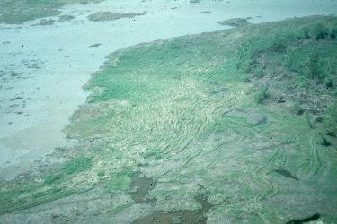
A blow out is a place (usually narrow) where tidal water flows into a deteriorating oil well key hole from adjacent marshes. Since a blowout carries a lot of organic material, it is a great place to fish, but it causes the marsh from which it flows to change to open water surface since it continually removes organic matter.
Note the opening at the end of the keyhole toward the lower right.
8. Toxic effects of sulfide accumulation in the wetland soils. In normal low salinity wetland systems, soils may cyclically stack up. Under natural circumstances, these soils will systematically be removed by natural processes or, if they remain, the sulfides that occur will be gradually detoxified. If natural removal and detoxification are prevented by human activities such as construction and maintenance of impoundments and canals (and their spoil banks), then toxic sulfide levels may increase and vegetation may die - possibly never returning.
9. Produced water. Water is produced from an oil well along with the oil. It is saltwater, usually 46 times saltier than the sea water (35 ppt) of the Gulf of Mexico. Produced water is separated from oil through a number of processes. It is then usually disposed of by one of two methods:
A. Deep well injection: it is injected deep underground. In the U.S. as a whole, 90% of produced water is injected this way.
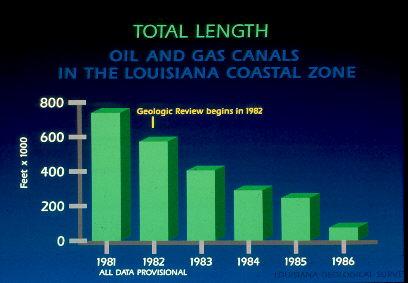
B. Discharged into surface water: In Louisiana coastal wetlands, 90% of produced water is discharged into surface waters, bayous, bays, canals, etc. In 1986, just 14 oil fields discharged 150,000,000 barrels of produced water.
The discharge of this water and its relationship to wetland loss has recently become a concern of the Louisiana State Legislature and others. Scientists at the Louisiana Universities Marine Consortium are studying this relationship.
Preliminary findings have not shown a significant impact to vegetation near a discharge site when the produced water is discharged directly into a water body. Historical aerial photography confirms these findings.
However, produced water discharged directly onto vegetated marsh instead of to a water body will have a serious impact. The plants will die.
In the late 1980s, it was estimated that about 730 million barrels (almost 31 billion gallons) of produced water were discharged annually in Louisiana waters. Not only is the brine potentially harmful, but there may be many other toxic substances present. Produced water has been shown to contain up to 2800 picocuries per liter of Radium 226 (the maximum allowable for the Riverbend Nuclear Plant near St. Francisville is 30 picocuries of Radium 226).
- Hurricanes and other storms. The heavier than normal pounding of waves on a beach or marsh washes soil and plants away. In SW Terrebonne Parish, Hurricane Andrew (1992) left marsh-balls (big chunks of marsh vegetation with their roots and soil) scattered about:
and flotant marsh pushed up like a blanket.
Some areas looked the same as before the storm, but the flotant marsh had been moved 150 ft. This same process recreated 1500 acre lakes during the Hurricane of 1915. Flotant marsh folded on itself during that storm formed ridges that were high enough so that upland plants, like Iva, began to grow and totally changed the overall aspect of the marsh.
If a storm pushes large quantities of saltwater into a marsh, the effects may cause immediate plant dieback, but this impact is seldom long lasting, yet it may weaken the marsh. Saltwater that stays on the marsh will eventually completely kill the vegetation.
The greenhouse effect may cause more frequent and more powerful storms in the future by adding more warmth to the atmosphere.
On a positive note, some studies have shown that hurricanes may be important in bringing enriching sediments to wetlands. There are no simple situations!
Surges are not always uniform throughout the marsh. Hurricane Andrew had the following surge levels in a rather small area:
Cypremort Point 0
Chauvin 5.9 ft
Cocodrie/LUMCON 8.3 ft
Just N Isle Dernier 12.0 ft
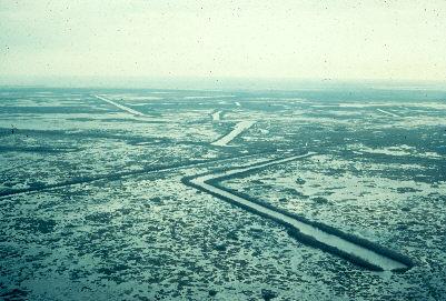
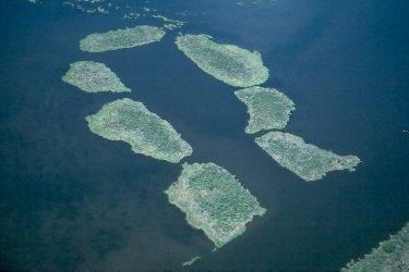
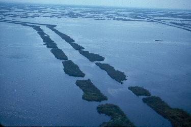
11. Canals and channelization. These have four effects:
A. Direct loss of marsh from canal construction. Canal surfaces made up 141.3 sq mi of our 4580.7 sq mi of coastal wetlands that existed in 1978.
B. In order to be efficient, canals are usually deep and straight; they do not meander like natural bayous. Some (such as the Mississippi RiverGulf Outlet) are like straws that draw saltwater straight into freshwater habitats, thus killing the plants.
Note the wonderful coastal wetlands that the MRGO traversed when built. Now scenes in the area are like the one below, a former healthy cypress swamp:

Another aspect of deepened canals is that they allow tides to impact deeper into the marsh. This happens when tidal flows move into areas formerly not affected by them, pick up organic materials, and suck them out to the open sea, thus removing them from the marshes.
One of the great economic ventures in our country is the Gulf Intracoastal Waterway (GIWW). It was initially built during World War II to allow for an inland passage way for shipping, extending from Carrabelle, Fl., to Brownsville, Tx. (it is 1,050 miles long and connects with the Atlantic Intracoastal Waterway [ICW], a 1,200 mile long inland passage between Norfolk, Va., and Key West, Fl., and the Okeechobee Waterway that runs across Florida from Stuart, through Lake Okeechobee, and down the Caloosahatchee River to Fort Myers). It was completed in its current form in the 1950s. Its original purpose was to allow inland passage of ships to avoid them being sunk by German U-boats as they left the mouth of the Mississippi River.
Once it was built, small communities along its path saw an opportunity to become economic centers by digging waterways from the GIWW to the Gulf. In so doing, they reasoned, they would be accessible to fishing and shipping traffic. For some, it worked. But what happened at every location is that the new waterways allowed saltwater to intrude into largely freshwater areas, thus killing the vegetation and allowing tidal flows to life the organic material, and drain it into the Gulf as the tide dropped. This caused the rapid demise of many of our state’s coastal wetland areas.
The GIWW path across Louisiana and its direct connects to the Gulf of Mexico.

How the GIWW progresses through New Orleans.
C. Since canals are unnatural waterways, they distribute water differently than Mother Nature, thus upsetting the balanced natural flow within the complex marsh ecosystem. As an example, natural ridges protect freshwater marshes behind them. If we put canals through the ridges, salt and/or floods get through and harm the freshwater marsh.
- As boats travel through canals, their wakes slosh against the bank and slowly but surely wash the soil away. As time goes by, plants are washed away and the channel widens. The MRGO started out 650 ft wide; now, in some places, it is 3000 ft wide.
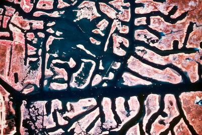
Below are a few photos of human-made canals in our wetlands.
12. Dredging. For years, dredging (to keep channels deep enough for shipping) used a screw dredge.

This type of dredge simply mobilized soil on the bottom, and the soil was moved down channel by the current. The dredge then moved down channel, mobilized the soil again, and it was swept further down stream. Ultimately, in many channels, the sediment was lost over the edge of the continental shelf.
Another system used was and is the hopper dredge. These ships have suction pipes extending from the hull to the bottom of the river. They suck up about 2-4 inches of surface sand and fill the hull of the hopper dredge. There are two types of hopper dredges: 1) split hull in which the ship is basically two hulls that attach down the mid-line on the bottom and 2) mono hulls with large doors in the bottom.
When they fill, the ship travels to a place where it can drop its load, the hulls open down the middle or the doors open, the sediment empties, the hulls or doors close, and the ship returns to fill again. Since the dumping often took place in deep water offshore, this was a monumental waste of valuable, delta-nourishing sediment.
Until 1980, only the Corps of Engineers owned and operated hopper dredges. At that time, industry was allowed to build and use them.
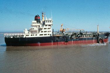
Hopper dredges look like regular ships. All the action is in suction pipes below the hull a
and the split hull or huge doors on the bottom of a mono hull.
- Spoil banks. Spoil banks are the piles of soil placed in ridges on the banks of a canal when it was constructed.
They provide upland habitat in the marsh and enhance production of certain wildlife, but there are problems.
Spoil banks are thought to harm wetlands in the following ways:
A. The marsh they are built on is covered and lost. In Louisiana, spoil banks covered 169.2 sq mi of the 4580.7 sq mi of wetlands that existed in 1978.
B. The flow of sedimentladed water into the marsh is blocked, the spoil banks serving as small but efficient levees.
C. Spoil banks change wetland's hydrology (water movement). They directly block the flow of surface waters and their weight on the soil blocks the flow of subsurface water.
D. Wetland drying cycles, caused by a natural, periodic absence of water, may be increased, thus promoting decomposition within the soil and causing subsidence.
E. Soil flooding duration may be increased because spoil banks may block the draining process. This may result in marsh plants being under water too long or waterlogging of the soil, thus promoting changes in water chemistry.
Spoil banks may not always cause serious problems in the wetlands, but when they cross natural levees they may form ponds that lead to wetlands loss.
- Filling, drainage, and development. Though actual filling and drainage of wetlands is not presently a major problem (due only to the strict enforcement of laws and regulations), it has been in the past and the threat still exists.
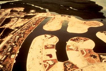
Humans love the wetlands, especially beaches. Unfortunately, developments along beaches tend to interrupt the natural processes of beaches and barrier islands and place human investments in conflict with nature.

Navarre, FL – 2001.
Mother Nature’s version of a coastal area.

Human’s love of coastal areas results in this set of conflicts.
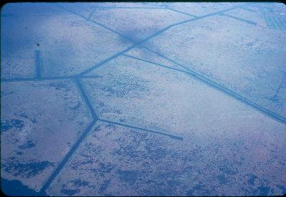
Decades ago, a major threat was the agricultural development of our coastal wetlands. Businessmen from the North bought up huge tracts of land for a nickel or so an acre. They built levees around and drained large areas, and grew incredible amounts of crops. However, when dry, the soil began to oxidize and subside, so the more it was drained, the lower it got and the more they had to pump more water out. Eventually, Mother Nature always won and the developments were abandoned. If you fly over coastal Louisiana and you see geometric patters of open water (such as squares, rectangles), you can bet it is a failed agricultural project. The following photo is of The Pen, an example at the edge of eastern Lafitte, LA.
Be sure to question proposed levee alignments. They've been frequently abused at taxpayers expense for the benefits of a few! Note the gall of the developers in the following article that appeared in the Times-Picayune.

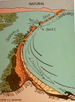
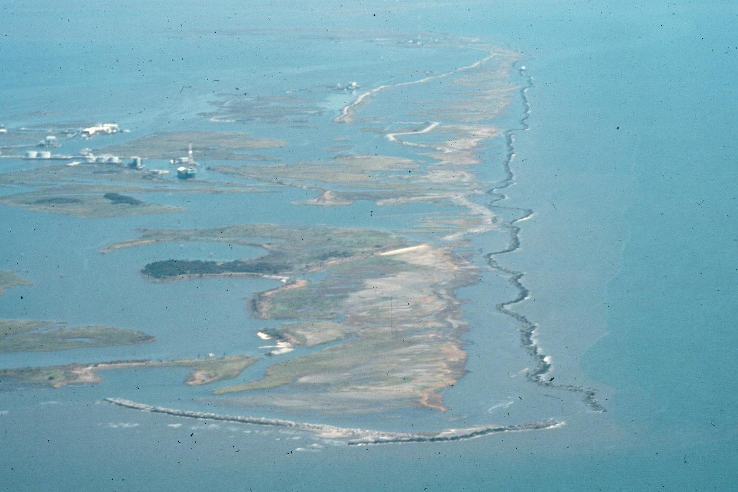
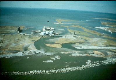
15. Loss of barrier islands. Barrier islands protect our coastal wetlands from the constant wave action of the sea and from storm damage. Hurricanes can cause devastating damage, as discussed above. Hurricane Camille (1969) cut Cat and Timbalier Islands in two. Hurricane Andrew (1992) virtually destroyed East Timbalier Island.
Sea level rise is gradually flooding our barrier islands. As they are gradually inundated, they are more susceptible to natural storm damage and erosion, much less the activities of humans. Even in our efforts to protect barrier islands, we have made mistakes. Techniques that use hard engineering (that is, methods that involve human-made structures) usually not only fail, but are often more destructive than natural forces.
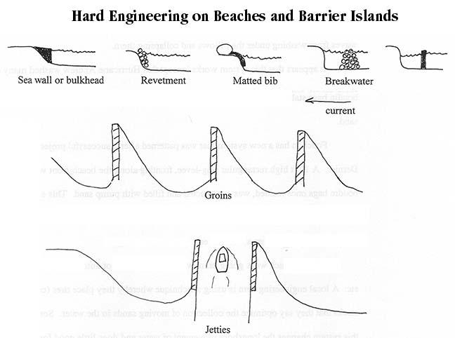
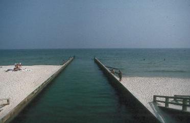
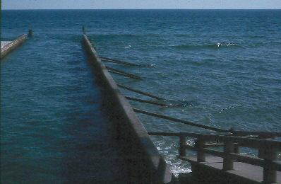
1. Groins - For years, people trying to stabilize beaches have used groins. These are structures (made of wood, concrete, piles of rocks, etc.) that extend into the water perpendicular from the beach. The theory here is that these walls will capture sand that is moving along the beach front in longshore currents. In fact, it usually works - at least for a while. By capturing the sand moving down the beach in the longshore currents, it cures a problem at that spot, but, by doing so, "steals" the sand from the beach down current. As a result, the beach tends to build on the up-current side and decline on the down-current side.
Louisiana’s most famous (or infamous) groins (though they were widely and incorrectly called jetties) were those implemented in Grand Isle by the former Mayor Andy Valence. They were constructed of huge boulders (four feet in diameter) in the Gulf adjacent to the Edgewater Hotel. After thoughtful consideration, Mayor Valence developed a unique design that was intended to build land, with plans for adding new groins seaward until about a mile of new land developed. The concept was that onshore waves carrying sediment would enter the rectangular area bound by two T-shaped groins, four breakwaters, and the retainer wall. In theory, water entering this area would lose energy and sediment would settle out and fill the space. Also, the rocks in the groins were spaced so that 15% of the longshore current would pass through them and deposit sediment on the lee side. Then a new groin system would be built seaward. In fact, theory was not borne out. But, as expected, sand built up on the up-current (west) side of the groins and the beach declined on the down-current (east) side - as expected. The only solution for protecting Grand Isle is the U.S. Army Corps of Engineers pumping offshore sands to create new beach.
Can you tell which way the longshore current is running on this beach in Grand Isle?

Or this one in Waveland, MS?
If the beach is relatively small and privately owned, this may be okay. But what if it saves one person's property and destroys another's? What if it saves one barrier island and destroys another?
2. Jetties - A very useful cousin of the groin is the jetty. A jetty is a wall extending into the sea from the mouth of a channel. Its purpose is to keep the channel open for boat traffic. Jetties usually work, but, like groins, they rob the down-current beach. Trade-offs! Always trade-offs!
The following photo was taken in Gulf Shores, Alabama, early one summer. Note that you can see that the beach is building out to the left and receding to the right. Look closely at the steps going down to the beach, then . . .
. . . look at the following photo that was taken from the same location a couple of months later. Note the stairs on the right and the sand in the upper right.
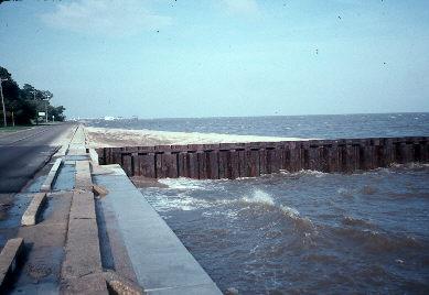
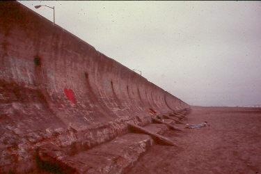
3. Sea walls, bulkheads, revetments – a). Shoreline revetments, or sea walls, are simply concrete walls built at the margin of the shore and the sea. Once these structures are established, the sand is washed away and the beach disappears. Eventually, a storm will undermine the structure.

The process is rather simple.
It is rare that a beach remains in front, and an island
remains behind, a shoreline revetment, or sea wall.
Timbalier Island, 1991 (by John Trowbridge). Another failed
shoreline revetment, or sea wall.
The seawall in San Francisco. The beach is very wide here, and seems to be stable.
Sometimes even groins become separated from land. In this case, it is the eastern tip of Dauphin Island, AL. August, 1989.
b). Bulkheads are similar, but when this term is used, it usually means that construction is of wood and it is often along a channel.
c). Revetment is a term used for any situation where banks are protected. This term is usually used for river bank protection, and not beaches. People use rocks, old pieces of concrete, plastic sheeting, old cars – whatever they have that works. However, a very common use is to stabilize the entrances to ports.
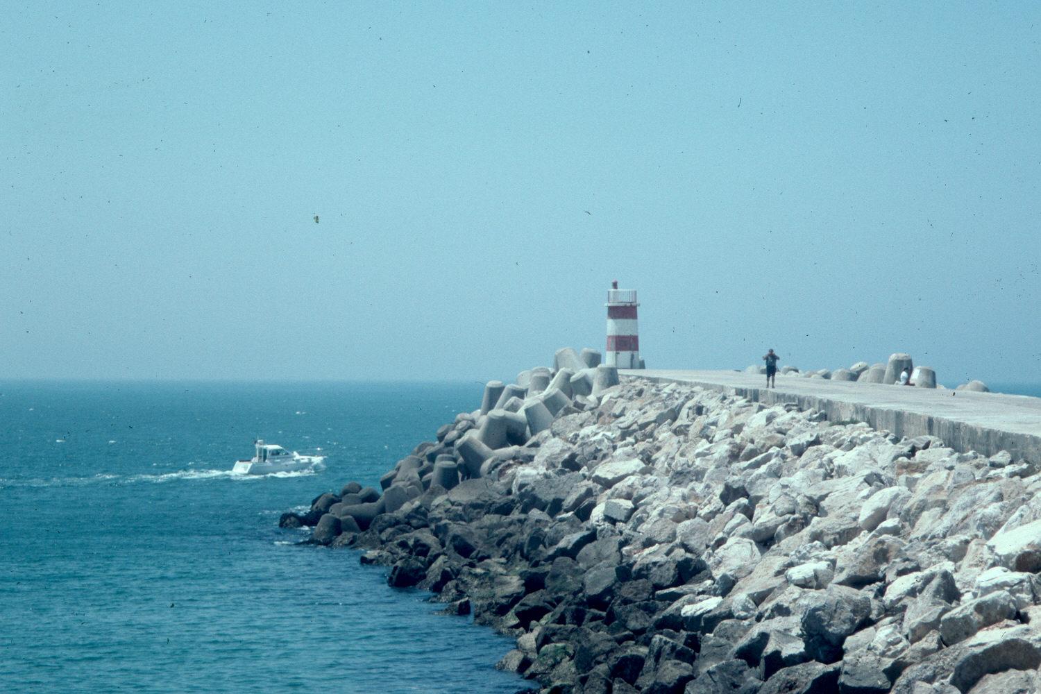
Revetment in at Atlantic port in Portugal.
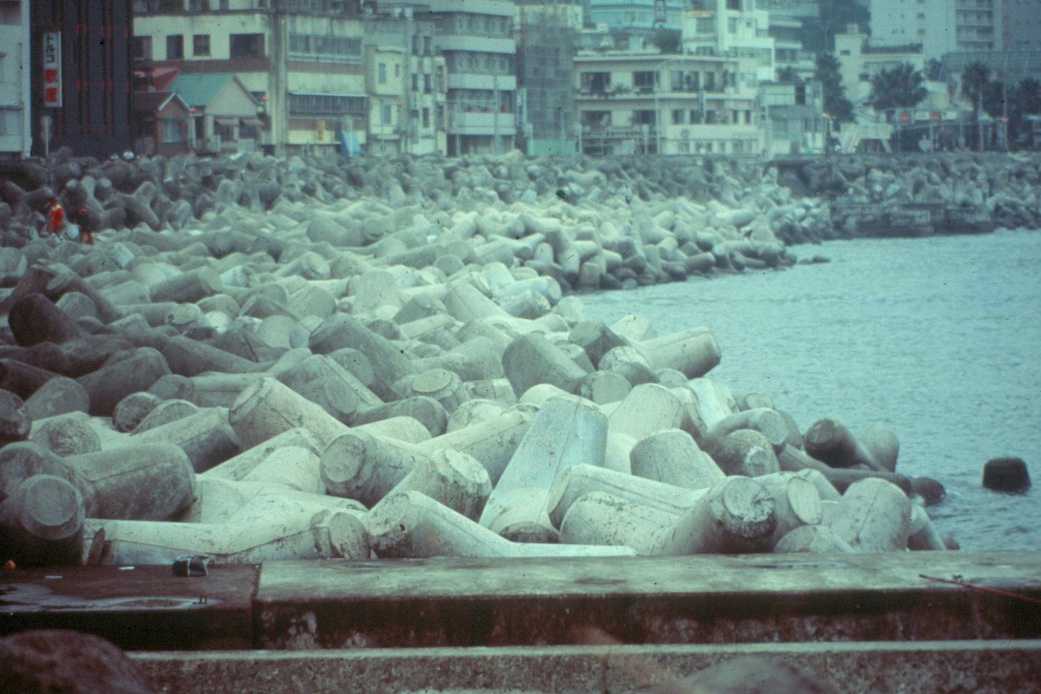
Tripod revetment used in a port in Europe.
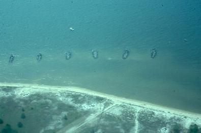
d). Breakwaters are walls built in areas where waves normally rush to shore. If placed properly, they are excellent devices. They are illustrated under “solutions” below.
16. Life cycle of the coastal marshes. It has been proposed that deltaic wetlands grow and degrade on a regular cycle. Garden Island Bay, located at the mouth of the Mississippi River, is believed to have developed and degraded over a 150 year period. Will it build again?
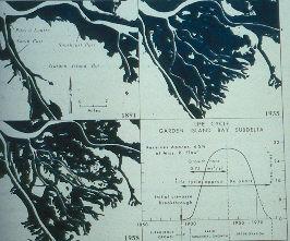
From Gagliano, Light and Becker, 1973, p. 25.
What percentage of our present wetland loss might be attributed to these poorly understood marsh life cycles?
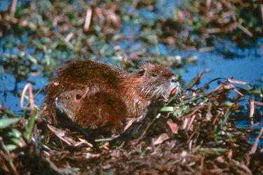
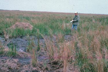
- Herbivory by wildlife. As discussed elsewhere, nutria, muskrat, and geese can and will eat all the vegetation in localized areas. When they consume all the surface vegetation and then the roots, this is called an eat out.

Nutria eat-out. Note the grass that could not be reached.
Muskrat eat-out.
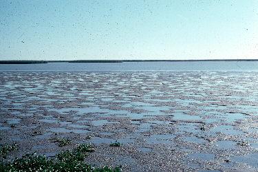
Goose eat-out at Delta National Wildlife refuge.
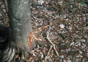
Nutria are the biggest problem at present because there is no market for them and they are severely overpopulated. They also damage cypress trees by stripping the bark from the lower portions of the trunk during the winter. Large trees seem unaffected, but smaller trees may die (they actually bite seedlings off at the base).
- Levee attempts. It appears to be futile (and very expensive to taxpayers-at-large) to build levees to stop the rush of the open sea. There have been a number of levees built in Grand Isle, and they have come and gone.
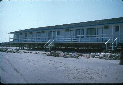
The Edgewater Motel was safe behind a levee until a series of storms washed it away and the tide began to wash under the buildings. September, 1989.

This is someone’s weekend home in May, 1991.
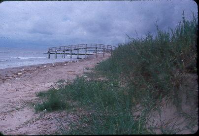
This “bridge to nowhere” was built over the Grand Isle levee so foot-traffic wouldn’t damage it. It took one good storm, and the levee was gone. September, 1987.
THE MOST RECENT FURTHER EVALUATION.
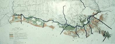
A recent study (Penland et al., 1996), initiated and funded by the Gas Research Institute through the Argonne National Laboratory, sought to evaluate, using Geographic Information Systems (GIS) technology, the human and natural causes of coastal land loss. They focused on localized impacts, and thus did not evaluate percentages for such huge contributors as river control, subsidence, and eustacy (worldwide sea level rise).
INDIVIDUAL GIS CLASS RANKINGS OF THE LOCALIZED PROCESSES OF COASTAL LAND LOSS1 (Note that each of these values are percentages of direct cause. Thus, Oil and Gas directly caused 11.01% of localized loss. Human causes are quantified at 53.73%, and natural causes are 46.27%).
|
|
|
|
|
|
|
|
|
|
|
|
|
|
|
|
|
|
|
|
|
|
|
|
|
|
|
|
|
|
|
|
|
|
|
|
|
|
|
|
|
|
|
|
|
|
|
|
INTEGRATED GIS RANKINGS OF THE LOCALIZED PROCESSES OF COASTAL LAND LOSS1 (This table takes the same data and integrates the direct plus indirect impact of Oil and Gas and Navigation upon localized coastal land loss. These data show that Oil and Gas overall contribute to 31.23% of the loss.)
|
|
|
|
|
|
|
|
|
|
|
|
|
|
|
|
|
|
|
|
|
|
|
|
|
|
|
|
|
|
SUMMARY OF REASONS FOR OVERALL LOSS OF COASTAL WETLANDS:
MOTHER NATURE -
natural sea level rise (especially the 1960/1970 eustatic event)
subsidence
storms/hurricanes
natural barrier island loss
marsh life cycles
muskrats and friends
HUMAN ACTIVITY -
increasing sea level rise (anthropogenic climate change)
mineral extraction
sediment reduction
accelerated barrier island loss
levees that prevented replacement of naturally subsided soils
channelization/canalization
using a screw dredge and randomly dumping hopper dredge sediment
spoil banks
filling, drainage, development
saltwater intrusion
increasing sulfide toxicity
produced water
barrier island erosion
controlling the channel so the river mouth empties at the edge of the continental shelf
coastal development
introduced nutria!